DRONIFI - TURF.SOLUTIONS
A REMARKABLE DIFFERENT APPROACH TO GOLF COURSE MANAGEMENT
Unmanned Aerial Vehicles (UAVs) are revolutionising the turf industry, introducing golf course superintendents to never before seen course data and actionable analysis. Through the use of UAVs, users can identify areas of plant stress that can not be seen with the naked eye, in addition to browning or yellowing of turf. Aerial imagery also provides insight into water distribution patterns, identifying specific areas where water applications can be reduced while maintaining healthy turf, aesthetics, and improving playability.
TurfSolutions, uses UAV's, mobile tools, image analysis, and the Internet of things to bring together a comprehensive software solution. Adopting TurfSolutions will give you access to software to manage, implement, and plan for UAV flights, image analysis, and task management.
MAP FEATURES
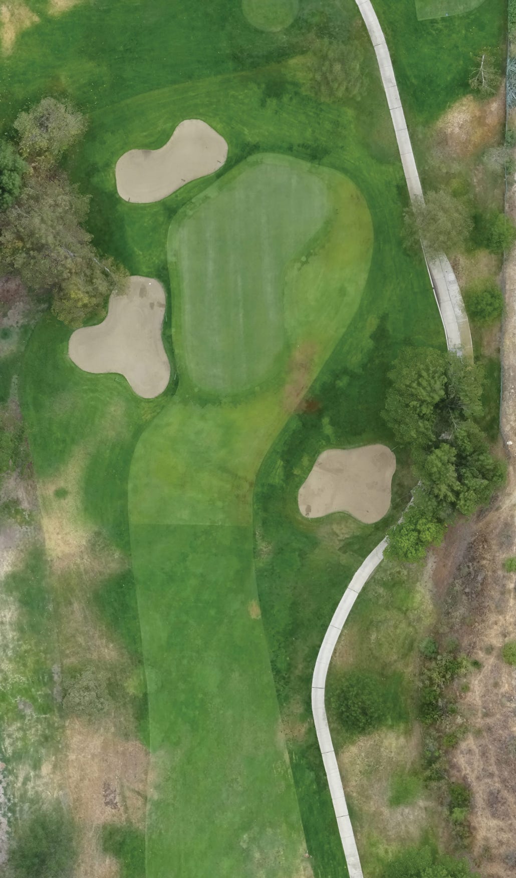
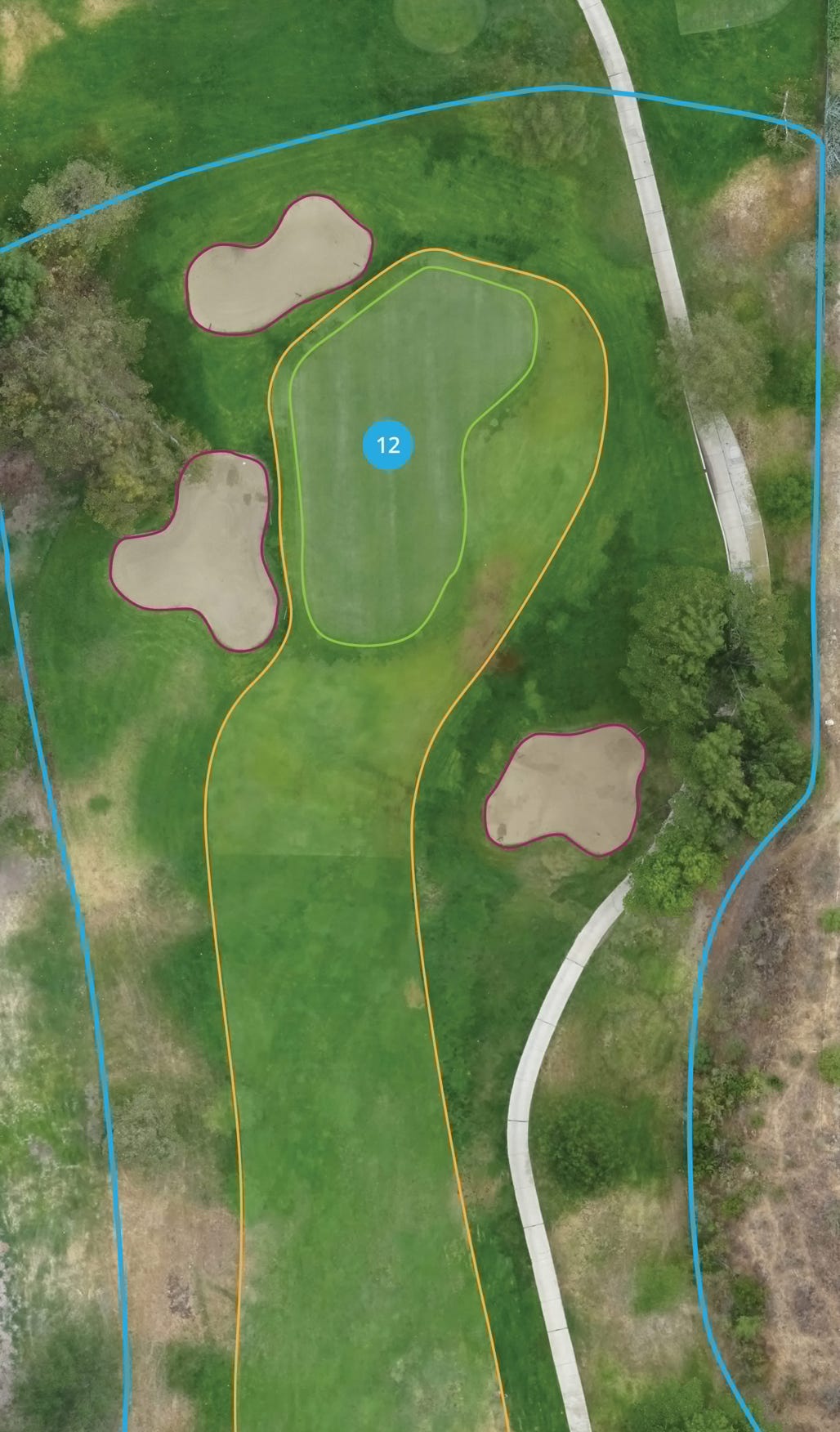
Map Key Course Features
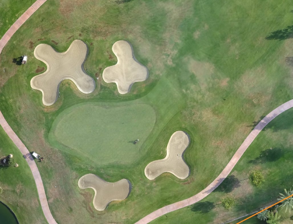
Produce current maps and 3D renderings of courses, allowing golf course superintendents to see overall course health and areas of turf stress. Utilising easy to use tools, superintendents and maintenance crews can monitor all course features, equipment and areas of interest from sprinkler heads to turf stress.

HOLE BOUNDRIES

GREENS

HOLES

BUNKERS

FAIRWAYS
Map Course Features
Identify Areas Of Concern
Detect areas of stress and seek opportunities for water reduction. These areas are presented via TurfSolutions’ software platform and are highlighted for management review. Using the TurfSolutions tools, problem areas can be tracked, follow up tasks can be assigned to maintenance crew members, and progress is monitored over time.
Mild Stress
Mild Stress
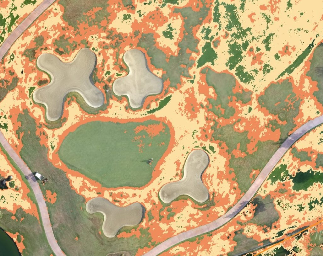
Severe Stress
Identify Significant Areas Of Stress
Detecting areas with high stress provides you and your team with valuable information to take action. Aerial image analysis can detect stress not yet visible to the human eye.
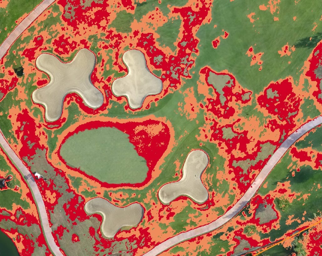
IDENTIFY PROBLEMS
TRACK PROGRESS
Track Progress
Track Problem Areas And Treatment Progress
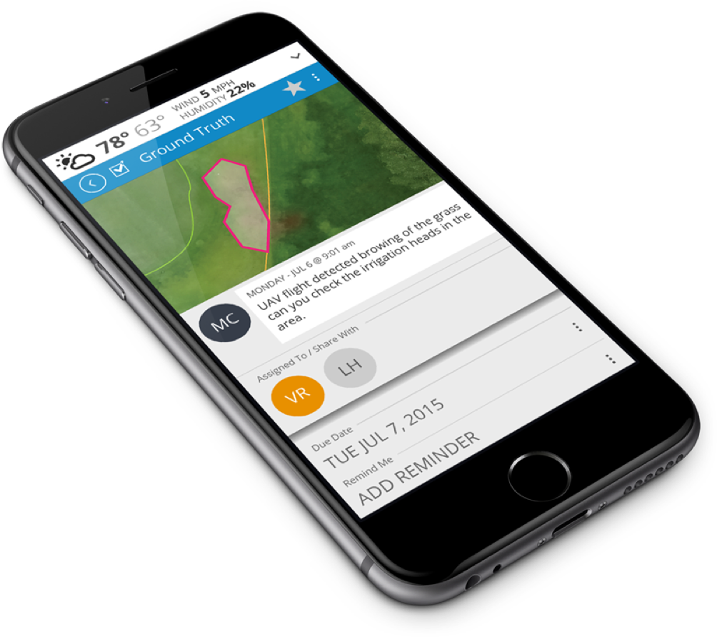
Detect and monitor areas of stress from flight to flight. These areas are presented via Turf.Solutions’ software platform and are highlighted for management review. Using Turf.Solutions tools, problem areas can be tracked, follow up tasks can be assigned to maintenance crew members, and progress is monitored over time.
PINPOINT AREAS
Pinpoint Areas Of Interest With Unmatched Precision
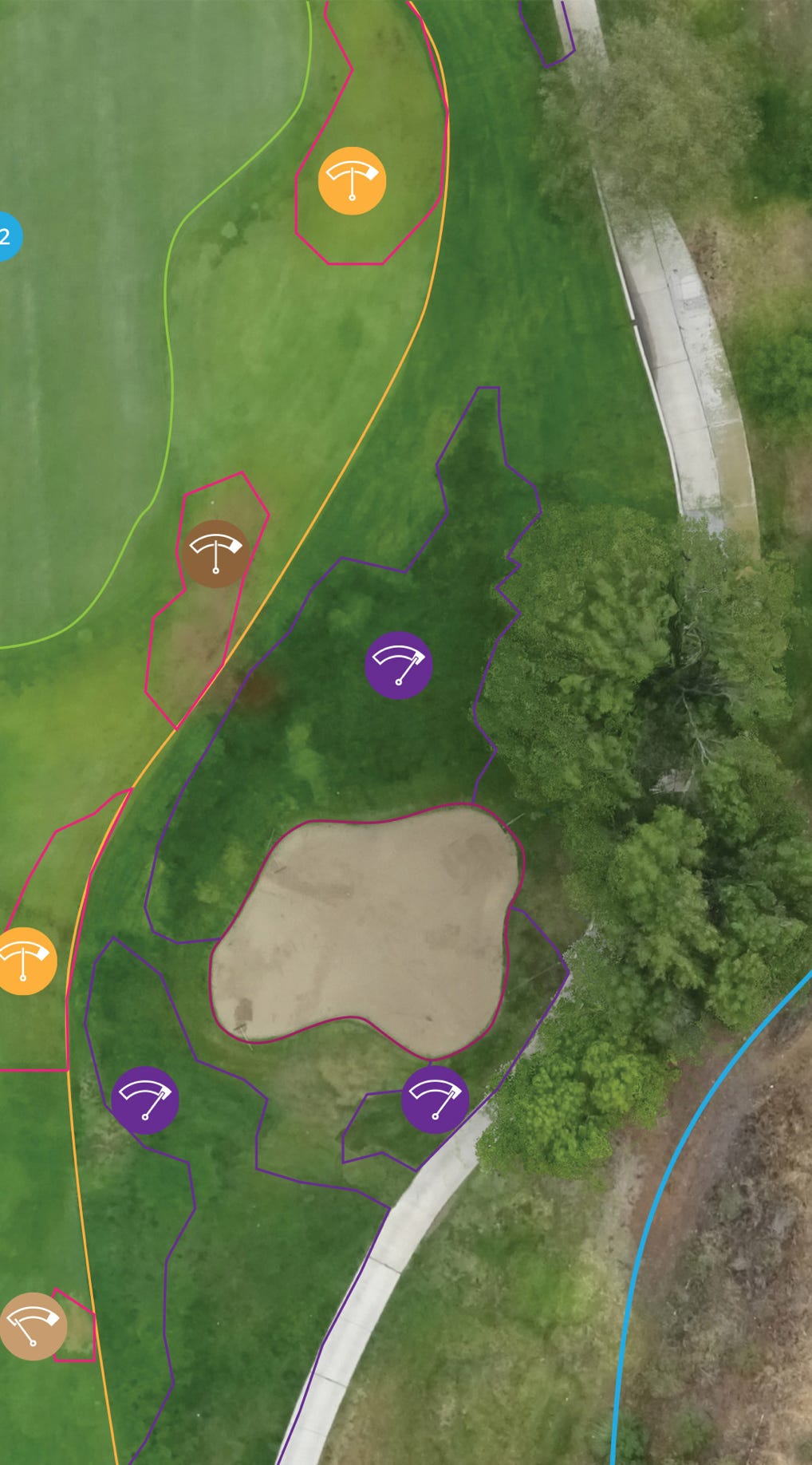
Track specific turf problems such as yellowing/browning spots and potential over watered or under watered areas and disease. Each critical area can be monitored over time to show reduction in turf browning, improving course appeal. Targeted areas dramatically improve chemicals and nutrient usage efficiency – only use what you need where you need it.

YELLOWING

LIGHT BROWNING

MODERATE BROWNING

SEVERE BROWNING

HIGH FLOURISHING
Pinpoint Areas
ACTIONABLE DATA
Transform Aerial Imagery Into Actionable Data
Using Turf.Solutions, areas of stress can be tracked from flight to flight and included in reports showing progress towards turf health and aesthetic goals. Stay up-to-date on turf health and improvement progress using your desktop or mobile device.
GET REPORTS
Progress By Location
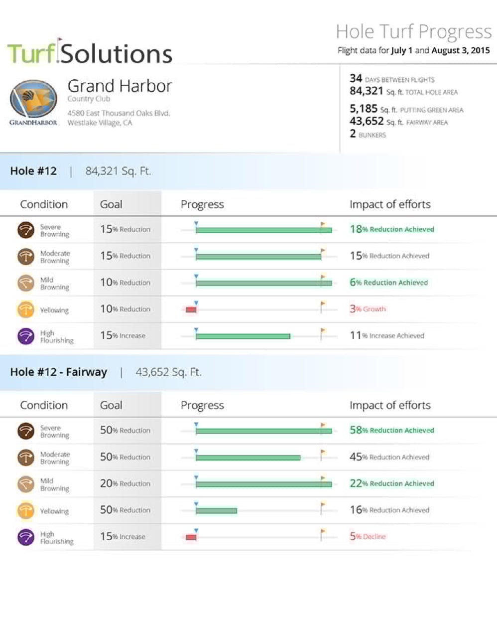
Track specific turf problems such as yellowing/browning spots and watering issues. Each critical area can be monitored over time to show reductions in turf browning and water use.
Hole Progress
Condition Progress
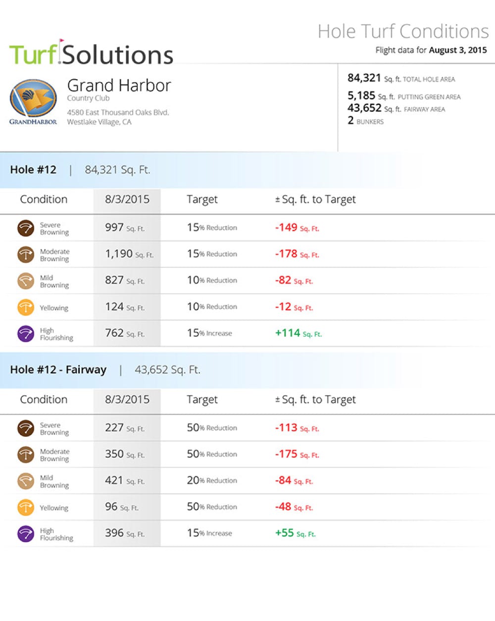
Get Detailed Reports Analysing Turf Health
Monitor areas by specific location in detail, and track progress towards reduction goals. Analyse turf conditions to determine how best to improve course athletics and optimise water use.
MORE INFORMATION
Southern Cross Drones are offering Dronifi’s Turf.Solutions to customers in Australia, New Zealand and APAC region. For more information about Dronifi products, please contact us by sending request to info@southerncrossdrones.com
Copyright © 2024 Southern Cross Drones Pty Ltd . All Rights Reserved